
Natural Bridge Loop - Nipika Mountain Resort - Recreation Sites and Trails BC
Columbia Valley Greenways Trail Alliance
Nipika Mountain Resort/ Cross River Canyon Recreation Site
-
14.75 km
Distance
-
66.29 mElevation Gain

-
1102.50 mTrail Head Elevation

-
1136.75 mMaximum Elevation

-
729.36 mCumulative Elevation

-
3-5 hour(s)
Average Time
Click on an image to enlarge

Trail Description
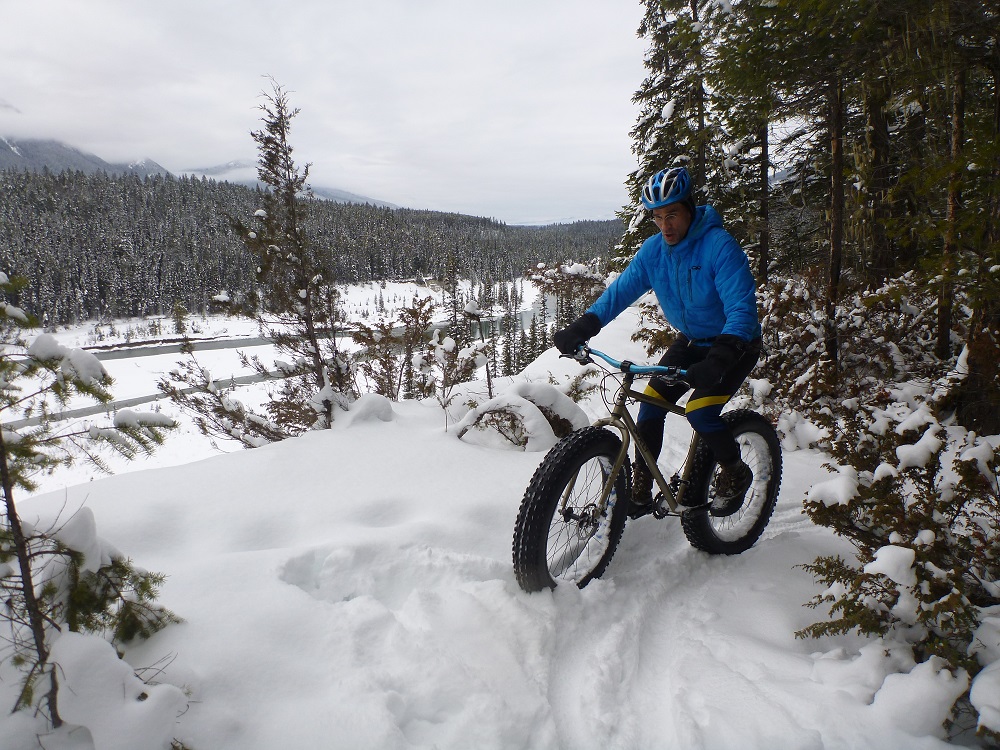
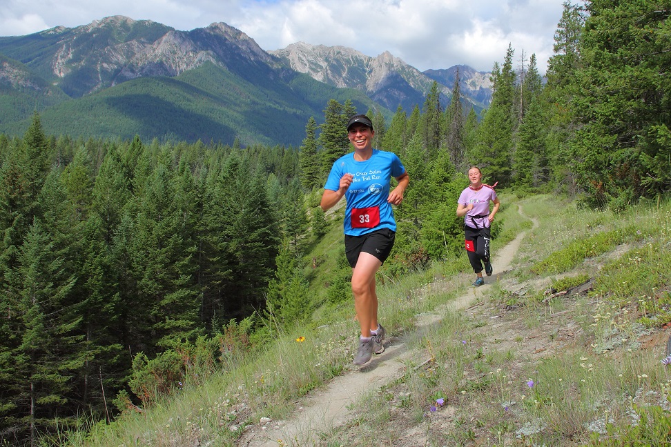
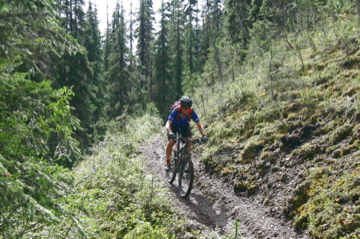
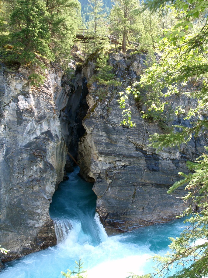
This is a single track loop great for mountain bikers, runners, hikers and snowshoers. For mountain bikers, this ride has an intermediate to difficult rating. From the trailhead at the day lodge take the ski trail north across the Nipika meadow to the ski trail called “Main Street” then look immediately for the single track “The Chamois Whammy” that exits on the left. This is a nice flowy downhill towards the Kootenay River. It turns north and follows the cliffs overlooking the river for about 1 km where you have the choice of descending a steep downhill and continuing along the shoreline of the river, or staying high to follow the ridge top all the way to the confluence of the Cross River. Start travelling up the shoreline of the Cross (a few steep uphills” some hike-a-bikes”). You are now on a section appropriately called “Cliff Hanger”. This section pops out and crosses the cross country trails then plunges into the forest on “Jesus Murphy” which weaves and winds for about another kilometre, crosses the cross country ski trails again and hangs along the cliffs overlooking the Cross River Canyon waterfalls. The next section is “Blow Your Chamois” and it will take you along the shoreline of the Cross River past the Canyon Bridge, all the way to the Natural Bridge. This is one of the highlight locations of the whole area, a great place for a break or snack, amazing views of the canyon and the deep river. From the Natural Bridge pick up the single track, “Riverview” that continues upstream along the cliff tops. A fun, rolling 3 km loop brings you right back to the Natural Bridge, where you will cross and look for the single track to drop down a steep hill on the left side of the ski trail 50 metres past the bridge. This “Bridge to Bridge” trail follows the very edge of the river all the way back to the confluence with the Kootenay River. There is a small cabin about three-quarters of the way along this route, good for another break. From the confluence of the two rivers backtrack to the Canyon Bridge, cross it, and go right up the ski trail for about 200 metres. At the top of a steep hill look for “Spin Doctor” on the left side of the ski trail, take it for about 300 metres and you pop out into a small clearing, ride up the short hill on the ski trail and cut into the single track “Tater–Tot” on the right side on the ski trail. Follow Tater-Tot staying left until you cross the ski trails again into “Early Retirement.” This is a fun rolling section which merges with “Rattle your Stuff.” When you pop back out onto the ski trails again, go right for a short distance down the hill looking for the single track “Killer Hill” to exit on the left. Drop down Killer Hill and stay left at the bottom, now you are on “Rufus’s Ramble” heading for home. One more rolling hilly kilometre on Rufus’s Ramble and you pop out of the forest right back at Nipika. Cross the Nipika Meadow back to your starting point, the Nipika Day Lodge.

Directions to Trail Head
Set your odometer to zero at the traffic lights on Highway 93/95 at the Invermere junction. Head north for 13 km to Radium. Turn right at the 4 way stop sign onto Highway 93 into Kootenay National Park (No park pass required if driving through to Nipika or Cross River Canyon Recrecreation Area). At 33 km, turn right onto Settlers Road. At 45 km (the 12 km marker on Settlers Road) turn left onto the Palliser Forest Service Road. Cross the Kootenay River Bridge, drive up the hill, and turn left into the Nipika Day Use parking area.

Detailed Map

Planned Mainenance and Trail Events
Crazy Soles Nipika Trail Run, May; Kootenay Krusher 50 km mtn. bike Race, June

Trail Surface
Dirt

Trail Season
Year round

Points of Interest

Uncommon Hazards
Some cliff exposure

Land Access Issues
non-motorized, non-shooting
Trail Features
Print Trail Information