
Chisel Peak
Columbia Valley Greenways Trail Alliance
Windermere
-
11.92 km
Distance
-
1310.13 mElevation Gain

-
1372.04 mTrail Head Elevation

-
2678.28 mMaximum Elevation

-
1325.06 mCumulative Elevation

-
5-7 hour(s)
Average Time
Click on an image to enlarge

Trail Description
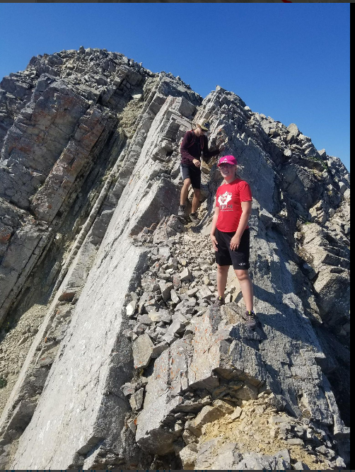
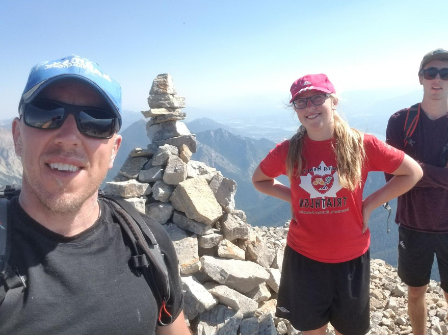
This is a "difficult" hike or easy scramble to the top of the Invermere/Windermere skyline. The views from the summit towards the columbia valley are breathtaking. The first half of the walk is on an OK trail mostly in the bush, but the last half involves a little class 4 scrambling or some. The summit traverse is not for the faint hearted and some exposure exists. Time between 4.5 hours (if I trail run this) or 10 hours for a leisurly walk with my kids.

Directions to Trail Head
U'll likely want a high clearance car for this. i took a sienna in however. From Invermere Cross Roads, head south on hwy 95 for 12.8km. Turn left at sign for Kootenay Number 3 road. after 100m at T turn right. after 1.9km turn right on Madias-Tatley forest service road. (this one sneaks up on you and is easy to miss). At the Y, take a right. Next Y take a left. You kinda think you're driving up into the wrong valley and u are, then it does a big dodgy traverse and descends towards the trailhead. you'll wish u had the hilux but just gas it in the minivan and you'll be ok, unless u have your girlfriend with you in which case she should probably get out and walk around the tricky stuff. if you're a teenager you actually can sleep the entire drive, somehow.

Detailed Map

Elevation Profile

Trail Surface
starts on old 4wd track for about 1.5km then, at creek/camp turns to a Quad Path for another 2km, then goes into single track in the forest. Some logs to climb over. Not well marked trail, but some cairns exist in the avalanche path. A bit scrambly and some loose rocks on the last push to the summit. Definately couple of class 4 moves here and there.

Trail Season
If you're equipped with crampons and iceaxe you co

Points of Interest

Uncommon Hazards
quad bikes.
Print Trail Information