
Findlay Falls Trail
Columbia Valley Greenways Trail Alliance
Close to Canal Flats
-
1.13 km
Distance
-
36.41 mElevation Gain

-
965.35 mTrail Head Elevation

-
966.00 mMaximum Elevation

-
80.37 mCumulative Elevation

-
<1 hour(s)
Average Time
Click on an image to enlarge

Trail Description
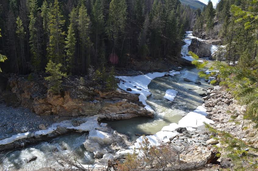
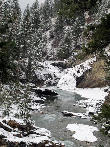
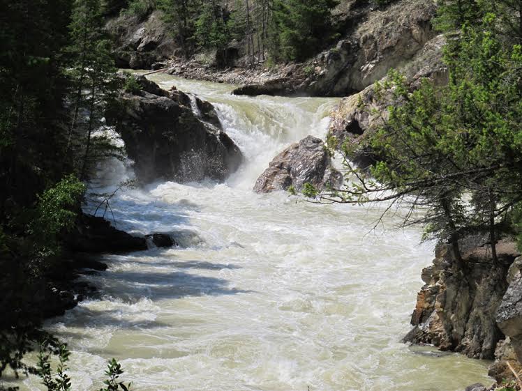
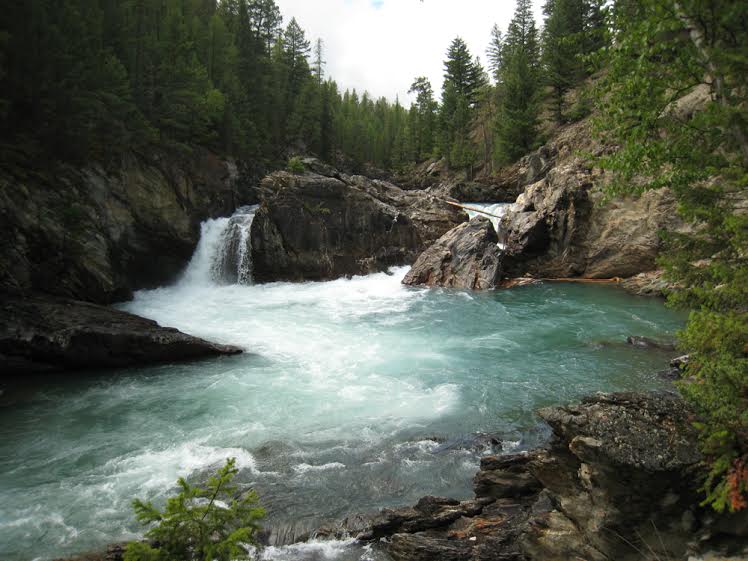
This short trail travels along the bank of Findlay Creek to a beautiful waterfall. About halfway to the falls, the trail narrows with steep drop offs on the left, and several places where the trail is washed out. If you are sure-footed you can proceed to the base of the falls, or you can view the falls from a distance before the trail narrows.

Directions to Trail Head
Pavement and good gravel roads to the trailhead, no need for a high clearance vehicle. Set your odometer to zero at the traffic lights on Highway 93/95 at the Invermere junction. Drive south towards Canal Flats on Highway 93/95. At 43 km turn right on Findlay Creek Road (about 3 km before Canal Flats.) Drive another 4.5 km (total of 48 km) and look for a small sign "Findlay Falls" on the left side of the road in a large clearing/camping area.

Detailed Map

Elevation Profile

Planned Mainenance and Trail Events
Trail wash- out needs repair/culvert

Trail Surface
Grass/gravel

Trail Season
Year-round with caution

Points of Interest
Trail Features
Print Trail Information
Hey. Nice trail