Cobalt Lake - Bugaboo Provincial Park
Columbia Valley Greenways Trail Alliance
Bugaboo Provincial Park
-
15.33 km
Distance
-
962.15 mElevation Gain
-
1516.66 mTrail Head Elevation
-
2478.80 mMaximum Elevation
-
1209.27 mCumulative Elevation
-
5-7 hour(s)
Average Time
Click on an image to enlarge
.jpg)
.jpg)
.jpg)
.jpg)

Trail Description
After a long ride on some rough roads, you may wish to do a little stretching before you tackle this hike. The trail starts with a series of steep switchbacks through an area that was logged several years ago. The initial elevation gain is about 600 metres over a distance of about 3.5 km. Be sure to check out the fabulous views of the Bugaboo Valley whenever you stop to catch your breath. After that steep climb, the trail flattens out briefly to an important junction. Turn left for an easy half kilometre hike to Walter Lake. Continue to the right for Cobalt Lake. The trail goes through an open basin of larch trees before beginning another unrelenting ascent to the top of the ridge at the 5 km mark. This saddle is where you will get your best views of the snow-capped peaks of the Bugaboo Spires and Cobalt Lake to the west. To get to the lake, follow the ridge north for about 1.5 km, then drop back down to the left in a southerly direction for another 1.5 km. Hike up to the waterfall coming from the lake, then climb a ramp to the left of the falls to get to your destination. You have a couple of options for the return trip. Go back the way you came, or angle back directly to the southeast for the saddle. This route is unmarked and requires some route finding skills and a little scrambling, but it will shorten your return trip by at least a kilometre.

Directions to Trail Head
Pavement for 42 km and 50 km of gravel road (variable conditions - high clearance vehicle may be needed). Set your odometer to zero at the traffic lights on Highway 93/95 at the Invermere junction. Head north to Radium for 13 km on Hwy 93/95. From the 4 way stop in Radium, continue on Highwy 95 towards Golden. At 42 km turn left on Brisco Road (signed the Bugaboos). At 42.5 km cross the railway tracks and follow the road to the right. At 45.5 km keep right at the junction to stay on Brisco Road. At 47 km keep right at another junction to continue on Brisco Road. At 50.6 km turn left at the junction onto Westside Road. At 53.2 km stay right. At 64.5 km turn right at yet another junction(turning left takes you to Cartwright Lake/Templeton). At 82.2 km you pass by the Rocky Point trailhead. At 89.3 km turn right at the junction at the Bugaboo Provincial Park sign. The Cobalt Lake trailhead is at 90.7 km. It offers limited parking. If the lot is full you can proceed to the Conrad Kain trailhead parking lot at 92.3 km and walk back along the road.
Detailed Map

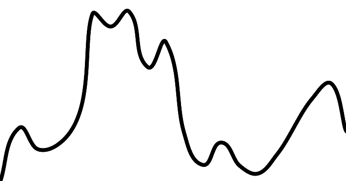
Elevation Profile

Trail Surface
Variable outdoor terrain

Trail Season
July - September

Points of Interest

Uncommon Hazards
This trail varies in length and difficulty depending on the route chosen. Moderate to Walter Lake (8K return/660 m elevation/2.5 H) and Ridge (10 K return/870 m elevation/3H 45 Min). Difficult - loop to lake (16 K return/6.5 H).

Land Access Issues
Parts of the trail are within Bugaboo Provincial Park and camping is not permitted in the Park.
Print Trail Information
