
Pedley Pass - Recreation Sites and Trails BC
Columbia Valley Greenways Trail Alliance
East of Invermere
-
8.76 km
Distance
-
472.72 mElevation Gain

-
1979.95 mTrail Head Elevation

-
2449.19 mMaximum Elevation

-
704.16 mCumulative Elevation

-
3-5 hour(s)
Average Time
Click on an image to enlarge

Trail Description
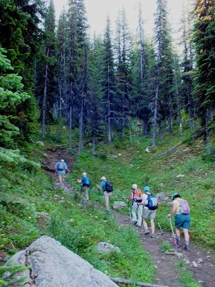
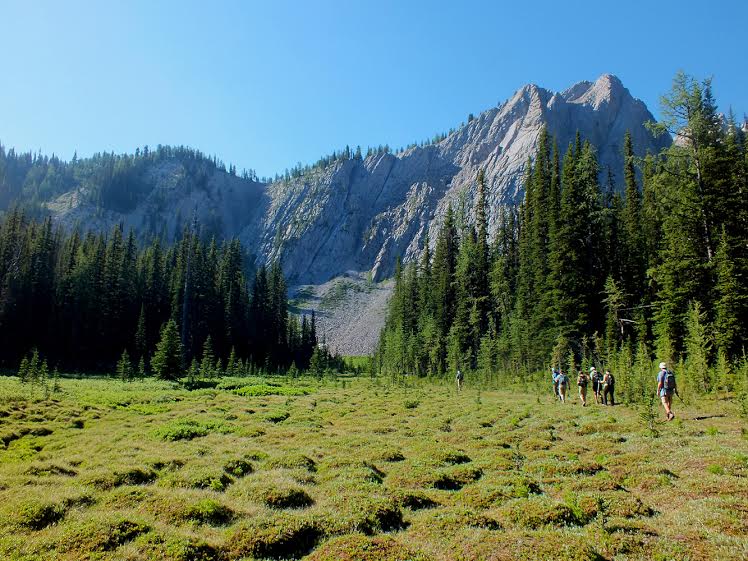
Pedley Pass offers options for hikers of all abilities and lots of room for exploration. Start at the south side of the parking lot and travel in a southwest direction. You’ll soon come upon ‘Bumpy Meadows’ – an area covered in large grassy bumps which are caused by frost heaving the soft moist earth. The trail stays to the left of the grey limestone headwall, steepens and climbs to the pass. With almost 2 kilometres under your belt you are faced with options. Return the way you came, continue in a southwest direction for another kilometre to visit a small alpine tarn and the slopes of Mt Aeneas, or continue eastward for a nice open ridgewalk. Choosing the lake offers fossil exploration on the slopes above. Mt Aenaes beckons those who like summit scrambling. But the ridgewalk is a favourite of a lot of local hikers. It travels east then swings north for almost 3 km of uninterrupted views of the Kootenay and Columbia River Valleys. To return and complete the loop, follow the trail as it descends off the ridge, travelling southeast for almost 3 km/ 450 m elevation loss before arriving back at the parking lot.

Directions to Trail Head
Set your odometer to zero at the traffic lights on Highway 93/95 at the Invermere junction and drive south for 2.8 km. Turn left on Windermere Loop Road (just past the gas station and bowling alley). At 6.1 km turn left into the Certainteed Gypsum site. Make an immediate right turn onto the mine haul road. Be cautious, you are now on an active mine haul road with big trucks travelling in both directions. Stay right at the fork at 9.4 km. At 13.9 km you will pass the mine site on the right. Continue on to a three way fork in the road at 15.8 km. The forks do not split evenly. Take the left fork, followed by an immediate turn onto the right fork (the middle road). There is a very rough section between 18 and 20 km that requires a high clearance vehicle and careful driving. Please be cautious as you navigate this stretch of the road. The parking lot and trailhead are another 2.5 km up the road.

Detailed Map

Elevation Profile

Planned Mainenance and Trail Events
This trail is actively maintained by the Summit Trail Makers Society in partnership with Recreation Sites and Trails. Please report any maintenance issues directly to them - summittrailmakers@gmail.com. Trail rerouting and maintenance is planned for the trail section leaving the N end of the parking lot travelling in a NE direction

Trail Surface
Variable outdoor terrain

Trail Season
Mid June to October

Points of Interest
Trail Features
Print Trail Information
Pretty good hike. The walk itself is a bit of a grind and the trail surface variable. Its well worth walking up either ridge beyond the pass for far more spectacular views and only adds a few minutes.