Lower Bugaboo Falls - Recreation Sites and Trails BC
Columbia Valley Greenways Trail Alliance
Northwest of Brisco
-
3.19 km
Distance
-
59.56 mElevation Gain
-
884.33 mTrail Head Elevation
-
922.00 mMaximum Elevation
-
203.45 mCumulative Elevation

-
<1 hour(s)
Average Time
Click on an image to enlarge
.jpg)
.jpg)
.jpg)
.jpg)

Trail Description
This is a hike with a very good effort/reward ratio. An easy 1 hour round trip walk through pine forests takes you to the spectacular Bugaboo Falls. Originating from glacier melt water high up in the Bugaboo range, Bugaboo Creek works its way down to join the Columbia River near Brisco. Depending on snow depth, this trail can be enjoyed most of the year. You can’t really do this hike justice with just one trip to the falls. The views of the falls change with the seasons; from the exciting turbulent high water flow in June/July to the slower flow, yet equally scenic ice formations in the fall and winter. Taking the left forks keeps you on the more worn path to the top of the falls where you must watch your footing and stay a safe distance from the edge. Taking the first left fork on the way back gives you optional views from the bottom of the falls but the trail is rough and steep. The second left fork takes you closer on ridges high above the creek with a few great view points before looping back to join the main trail.

Directions to Trail Head
Pavement for 42 km and good gravel road for 11 km to the trailhead. Set your odometer to zero at the traffic lights on Highway 93/95 at the Invermere junction. Head north for 13 km to Radium. Continue through the 4 way stop in Radium toward Golden on highway 95. At 42 km turn left onto Brisco Road toward Bugaboo Provincial Park (just before Brisco). At 42.5 km cross train tracks and follow the road to the right. At 45.5 km turn right at the Y-junction staying on Brisco Road. At 47 km turn right at another Y-junction to stay on Brisco Road. At 51 km turn right at the junction onto Westside Road. Watch for the Lower Bugaboo Falls sign on the left at 53 km.

Detailed Map

Elevation Profile

Trail Surface
Variable outdoor terrain
Trail Season
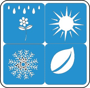
Early spring to early winter

Points of Interest

Uncommon Hazards
Sharp drop offs with no protective barriers or rails
Print Trail Information
