
Hoodoos Trail
Columbia Valley Greenways Trail Alliance
Off Westside Road south of Invermere
-
4.79 km
Distance
-
122.22 mElevation Gain

-
970.08 mTrail Head Elevation

-
972.75 mMaximum Elevation

-
175.68 mCumulative Elevation

-
2-3 hour(s)
Average Time
Click on an image to enlarge

Trail Description
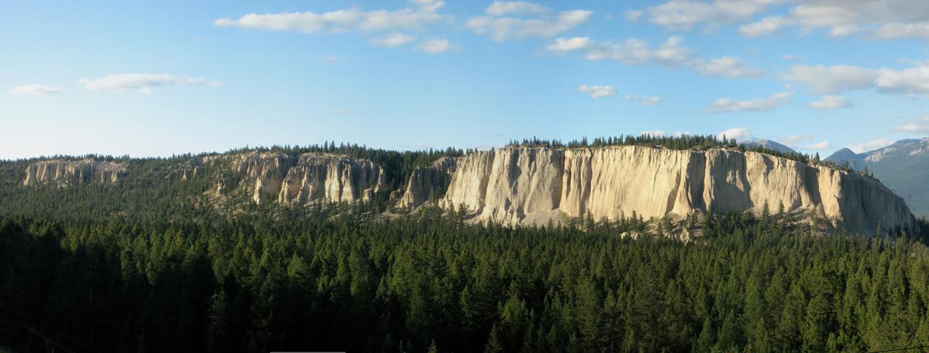
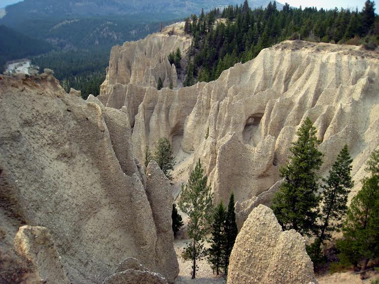
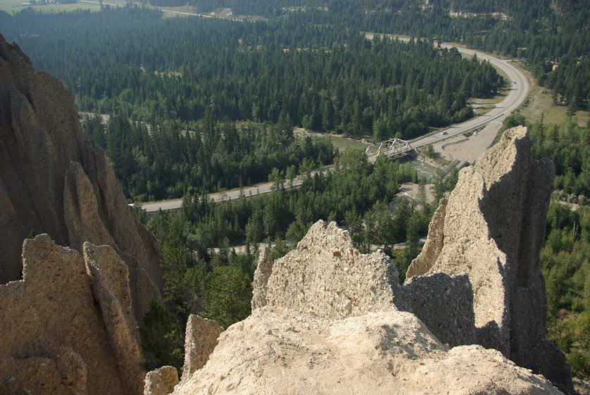
This is a good hike for all of the family. It starts with a moderate uphill climb to the top of the hoodoo formations. Great views all the way up culminating in vistas to the south of Columbia Lake and much of the valley. The trail winds its way along the top of the hoodoos before circling back on an old road and returning to the parking lot. This hike is definitely worth the effort.

Directions to Trail Head
Set your odometer to zero at the traffic lights on Highway 93/95 at the Invermere junction. Head south towards Fairmont Hot Springs. At 27 km, just past Fairmont, turn right onto Westside Road. At 28 km turn left into the parking lot

Detailed Map

Elevation Profile

Trail Surface
Old roads, dirt, grass

Trail Season
Year round

Points of Interest

Uncommon Hazards
Steep drop offs from the top of the Hoodoos. Stay well back.
Print Trail Information
Nice hike, but it is much shorter than 2 to 3 hours. It only took us 50 minutes. Perhaps this is because a section of the trail is cordoned off.
Very popular easy trail. The views are quite stunning looking down the hoodoos. Watch your footing and small children while overlooking the talus spires.