Juniper Trail - Kootenay National Park
Columbia Valley Greenways Trail Alliance
Kootenay National Park
-
6.56 km
Distance
-
211.08 mElevation Gain
-
898.50 mTrail Head Elevation
-
1098.77 mMaximum Elevation
-
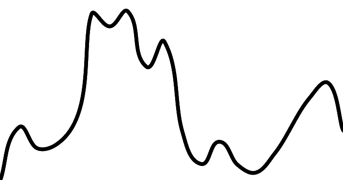
582.96 mCumulative Elevation
-
2-3 hour(s)
Average Time

Trail Description
This loop trail is best started and ended at the Radium Hot Springs Pool. Begin your journey on the north side of the highway. The trail starts at the northeast corner of the parking lot and steadily gains elevation as it climbs through a forested area that is currently being reclaimed (thinned to prevent future forest fires). Within a kilometer you are rewarded with views to the west at several viewpoints along the trail. You can see the highway winding below, the town of Radium and beyond that the wetlands of the Columbia River and the Purcells in the background. Spectacular scenery with minimal effort as the trail winds along the edge of Sinclair Canyon. The trail then drops down into Sinclair Canyon, where temperatures are noticeably cooler along Sinclair Creek. You'll appreciate this refreshing break on a hot day so spend some time along the creek to check out the waterfall and some of the interpretive signs. You'll notice a change in vegetation as well, as Juniper trees thrive in the cool, damp climate. Climb back up out of the canyon to the highway and walk east a short distance along the highway. To continue onto the Redstreak Campground Trail, watch for the trailhead sign on the right side of the highway about 200 m away. Watch for traffic as you cross the highway, then work your way up a series of switchbacks to the south end of the Redstreak Campground. At the top, take a short detour to your right to the wooden viewing platform. Return to the trail and continue on through the forest as the trail parallels the highway before dropping back down and ending at the Radium Hot Springs pools. Reward yourself with a swim, soak or ice cream!

Directions to Trail Head
Set your odometer to zero at the traffic lights on highway 93/95 at the Invermere junction. Head north for 13 km to Radium. Turn right at the 4 way stop sign. Stop at the Park gates and buy a pass if necessary. There is parking at the pools at 16.2 km on both sides of the road.
Detailed Map

Elevation Profile

Trail Surface
Variable outdoor terrain

Trail Season
Year round depending on snow depths

Points of Interest
Trail Features
Print Trail Information
