
Brewer Creek - Recreation Sites and Trails BC
Columbia Valley Greenways Trail Alliance
Southwest of Invermere
-
11.53 km
Distance
-
521.07 mElevation Gain

-
1897.59 mTrail Head Elevation

-
2418.66 mMaximum Elevation

-
617.60 mCumulative Elevation

-
5-7 hour(s)
Average Time
Click on an image to enlarge

Trail Description
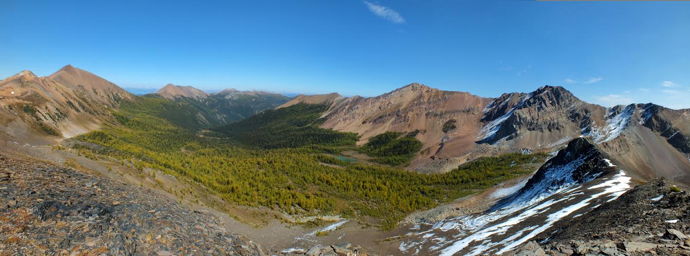
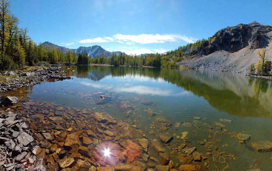
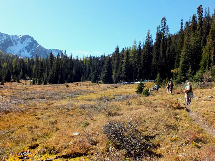
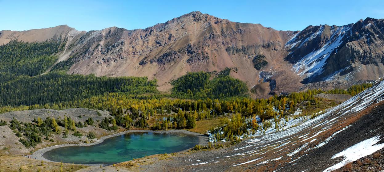
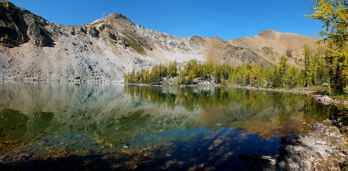
This hike is another local favourite. Wet marshy areas, the sounds of a bubbling creek, beautiful open meadows and crystal clear tarns – Brewer Creek offers something for everyone. Noted for its variety and many options for exploration, this can be an easy day hike or it can be extended and linked to other hikes. The trail starts on an old road and crosses both Brewer Creek and a couple of small streams before coming to an open area. After about 800 m it swings into the forest for about a kilometre. That’s followed by some steep sections and a couple of marshy areas. Parts of the trail are not clearly defined. Once you reach the Brewer Creek Basin follow the trail to the right to a couple of tarns at the base of Mount Brewer. If you want to extend your day, a scramble up to Brewer Pass at the end of the basin will give you some great views of Mineral Creek to the west and the entire Brewer Basin.

Directions to Trail Head
High clearance vehicle needed. Set your odometer to zero at the traffic lights on Highway 93/95 at the Invermere junction. Head west into Invermere. At 2.8 km turn right at the lights by Sobeys. At 3 km turn left at the T-intersection (10th Ave). At 3.7 km turn right on 13th St. At 4.1 km turn left onto 13th Ave. which becomes Westside Road after you leave Invermere. At 18 km turn right onto Hawke Road. At 26 km turn right after crossing a cattle guard. At 29 km turn right on Brewer Creek Forest Service Road. At 29.7 km turn left at the Y-junction dropping down to the valley bottom. At approximately 33 km turn right at the Y-junction staying on Brewer Creek FSR. Take next right at 34Km, then L at 36 Km Y. At 42 km cross a bridge over Brewer Creek. The last 2 km can be very rough. The trailhead is at 44.2 km.

Detailed Map

Elevation Profile

Planned Mainenance and Trail Events
This trail is actively maintained by the Summit Trail Makers Society in partnership with Recreation Sites and Trails. Please report any maintenance issues directly to them - summittrailmakers@gmail.com.

Trail Surface
Variable outdoor terrain

Trail Season
Summer, early fall

Points of Interest
Print Trail Information